
Marion County
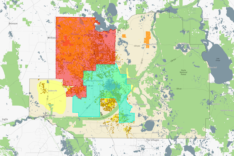
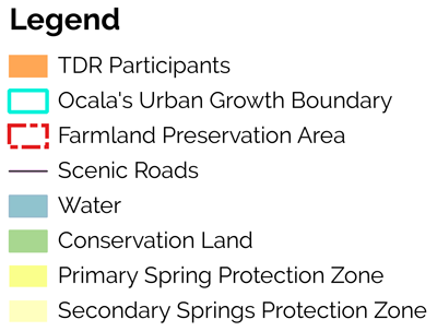
Below is a map of the Farmland Preservation Area (red shaded area) in Marion County, Florida. This area is home to some of the County’s most pristine horse farms that create the character and culture of Ocala/Marion County. The blue shaded area represents the Urban Growth Boundary. Green shading is Conservation Land.
The County maintains an interactive online version of this map with many layers. We invite you to log in and explore the zoning districts and property boundaries in detail.


