fbpx
Perdue Emphasizes Community Engagement in Road Planning

Perdue Emphasizes Community Engagement in Road Planning

What’s In Store For Marion County’s State-Owned Road Projects?

At Horse Farms Forever’s Conservation Summit on November 14, Jared Perdue, Secretary of the Florida Department of Transportation (FDOT) and Tracy Straub, Assistant Marion County Administrator, shared detailed information about Florida’s transportation approach and goals, and specific road improvement projects in Marion County. Secretary Perdue, who took over the post this past April, gave an update on the improvements to I-75 and the Northern Turnpike Extension project, which will resume in one to two years. He also emphasized FDOT’s new emphasis to recognize and protect the unique heritage and culture of Florida’s communities while at the same time improving road safety and efficiency.

The partnership between FDOT and Marion County was also highlighted as a vital component to completing nearly 42 road improvement projects that will widen and extend roads, build several flyovers, and a new interstate interchange at NW 49th Street. These projects will help divert traffic off of I-75 and allow residents to travel both north-south and east-west without having to access I-75. This blog will highlight important aspects of Secretary Perdue’s presentation. We will cover Administrator Straub’s in detail in the next release. To Summit livestream was recorded, and is available for viewing here.

Efficient Transportation Challenged By Astronomical Growth

At the beginning of his talk, Secretary Perdue shared that the core FDOT mission is to provide safe and efficient transportation for the citizens of Florida, and to support the supply chain of goods and services. This is a challenge as Florida’s population continues to grow.

“This is one of the challenges with transportation – how do you provide necessary transportation, but still protect and conserve what makes Florida special,” said Secretary Perdue. “We have a unique challenge in Florida. We are the third most populous state in the union. We are growing rapidly, exponentially. Sixty percent of our growth is concentrated in 10 Counties: Osceola, St. Johns, Sumter, Walton, Lake, Orange, Santa Rosa, Manatee, Nassau, and Lee.. A lot of areas in Florida are growing at 20 percent annually.” Perdue shared that for every 100 people that move out of Marion County, 500 move in. “FDOT plans transportation projects based on a 3 percent population growth rate, and many areas of Florida are growing in excess of 20 percent, and so here’s what that means for an individual,” he said. “Yesterday, you had a 30-minute commute to work. It’s almost like you went to bed and woke up the next morning and all of a sudden, you’re sitting in traffic for an hour and a half trying to get back and forth to work.”

Transportation systems typically take 15 to 20 years to complete because of limited and finite resources that have to be spread across a very large state. FDOT must focus on a long timeline – planning for growth two decades in the future while maintaining enough capacity to handle emergency situations, like the recent devastation from Hurricane Ian. This year’s FDOT budget of $12.6 Billion is the largest in history.

“The challenge is because those areas have been growing so fast, 20, 30, and some areas even 40 percent growth, and so here’s the challenge, how do we think about transportation infrastructure differently so that we can start to catch up strategically,” he added.

Northern Turnpike Extension Is Still In The Plans

Secretary Perdue answered the most pressing question about the proposed NTE project to extend Florida’s Turnpike from Wildwood to U.S. 19 in Levy County. The NTE project was paused earlier this year, but Perdue confirmed that it was still in FDOT’s plans. The time frame has not been determined, but work on the proposed NTE project will start within the next one to two years. The project was paused due to the overwhelming negative feedback about the proposed routes from the communities in its path. FDOT’s response was to hit the pause button.

“Yes, we hear you, we don’t want to put a road through the heart of your community,” he said. “But we know we have to do something so let’s step back, let’s reengage with our communities and let’s talk about what those right solutions are because we know we need something.”

Perdue said the Northern Extension will connect to I-75 because it fits together as part of a bigger picture of how to solve the transportation challenges; because Florida is going to continue to grow and people and goods and services need to get from point A to point B. The NTE is also important for the future in terms of resiliency, hurricane evacuations, and natural disasters.

“We know we need to do something,’’ he said. “We want that something to preserve your farmland, to fit the growth patterns that are occurring. We want that something to continue to provide the needed transportation while embracing and maintaining the character of your community. And we believe that there’s a way to do that.”

A Love For Rural Florida

“I love the idea of protecting horse farms. I love horses and owned them myself,” he said. “I love Marion County and I love rural Florida. I was born and raised in rural Florida, so it’s really important to me.”

Secretary Perdue emphasized FDOT’s value on relationships with local governments and the goal to embrace and protect the character of communities.

“The reality is that anytime we set out to do something important, the way that people feel and that way that we engage them matters. It is absolutely critical for the future success of transportation systems in Florida,” said Secretary Perdue. He also addressed preservation and conservation directly. “What does that mean for how we deliver transportation in the future?” asked Secretary Perdue. “We believe that in order to successfully deliver infrastructure for the future based on the way that society has changed, based on the way that the state of Florida is changing and growing and adapting, that the absolute number one priority is for transportation infrastructure to embrace communities.”

He described the diversity of Florida and how important embracing this diversity is for transportation projects. Each community has its own culture, heritage, traditions, and also its own vision for the future.

“We believe that enabling transportation infrastructure to be a part of that heritage, a part of that tradition, but also a part of that vision for the future is where success is in transportation infrastructure,” he said. “This has become an umbrella focus for us. We believe that every single transportation infrastructure project can truly embrace the community that it lies within.”

Question from Kevin Sheilley of the Ocala Metro CEP

QUESTION:

Two recent hurricanes came through Florida, 1 hitting the southwest coast and another the southeast coast.

  •  How did the interstate system handle the evacuation routes from the coastal areas?
  •  And, does there need to be a connection between the Suncoast Parkway and I-75 to enhance evacuations?

ANSWER By Secretary Perdue:

“There are a lot of complexities that go into evacuations, depending on where the storm is going, how much time people have to make decisions and what available routes there are. Depending on where the storm hits in Florida the plan completely changes. With Hurricane Ian, the path was changing constantly. The forecast wasn’t set in stone and it changed at the last minute. People had hours to figure out what to do.

We have outfitted our interstate system with technology so that we can watch evacuation behavior in real time. In the case of Ian, we saw a lot of congestion on I-4 and I-75 in general – in particular those hot spots where traffic is always an issue. If the facility is not reliable in everyday life, how is it going to be reliable in an evacuation?

Did our facilities do well during the Hurricane. I would say the answer is yes. Everybody that decided to get out, got out. We opened the shoulder of the road to help with traffic flow, but those pinch points on I-4 and I-75 were still there.

We want to build facilities to be reliable and resilient. To do that, you have to not only relieve those problem areas that already exist, but also build out for future growth.

We believe that something is needed for evacuation between I-75 and the West Coast. We will have to work through that solution together.”

Question from Navroz Sanju of HDG Hotels

QUESTION:

We hear a lot about autopilots in cars and self-driving trucks.

  •  What is the future of self-driving cars and self-driving trucks on the interstate system?
  •  And is there any new technology you are including when you build a road to work with those systems?

ANSWER:

“Technology is one of our big strategic focus areas. Here in Florida we have 100 percent coverage of our Interstate System with the most current detection devices. We have the backbone in place for the future of autonomous driving vehicles. Technology changes so fast, and there’s been a lot of emotional speculation about what the future will look like.

We’ve developed new standards for these technologies to work. Artificial intelligence is always collecting data and using it to make decisions. Our infrastructure needs to facilitate that.

So, what’s realistic over the next ten to twenty years? First, there is tremendous efficiency to be gained on interstates using autonomous technology, such as the platooning of trucks. Our facilities must be upgraded for this future. We are already working on that. Autonomous vehicles can test and pilot on the Florida Interstate System. Second, what is really important is the ability of technology infrastructure to communicate important information to every day drivers – lane closures, stopped traffic, and accidents can be communicated to navigation apps by the road itself, helping drivers to make decisions.

We recently rolled out a pilot program that will allow every lane closure to be shared in real time with navigation apps.”

Early Feedback

Getting early feedback from communities is a new way of thinking for FDOT, but Secretary Perdue said that it’s “been hugely successful. Sitting down with communities before we decide what’s going to be done on that project to ask you: Hey what do you want to see – What would you like the feel of this roadway to be – How would you like it to look – What type of things would you like to see incorporated to help it align with your community?”

He said one example of this approach is the Wekiva Parkway, which protected more land for conservation than it impacted.

“I’ll give an example in terms of preserving and conserving with transportation actually having a net positive impact on what Florida’s true character is with the Wekiva Parkway in central Florida,” said Secretary Perdue. “A lot of the Wekiva Parkway, that’s a new toll facility, utilized an existing road, State Road 46 for a lot of the way, and we had a net positive impact on the environment because we actually purchased more conservation land as part of the project than we impacted with the project itself.”

However, due to FDOT budget constraints, not all suggestions are possible, but, when FDOT engages communities early in the process, the community becomes part of the team.

“Then we together can implement infrastructure that takes on the character of the community that it lies within,” he said.

Improvements to I-75

FDOT is coordinating closely with Marion County on nearly 42 projects and one of the top priority projects is improving I-75. The traffic congestion is a capacity issue, but it’s also related to the surrounding road network and because the Florida Turnpike ends at I-75 just south of Marion County. The goal of the master plan is to enhance mobility, improve reliability, and safety. There are two phases to the project with phase one adding additional lanes in each direction between SR 44 and SR 326. Phase one also includes interim modifications of the SR 326 and SR 40 interchanges. Phase two is ongoing.

The I-75 Master Plan is also divided into two study areas. The Southern section is approximately 22.5 miles and it begins at Florida’s Turnpike, SR 91 in Sumter County and ends at SR 200 in Marion County. Interchanges to be evaluated include Florida’s Turnpike, SR 44, CR 484 and SR 200. The Northern section is approximately 25.3 miles and it begins north of SR 200 in Marion County and ends south of CR 234 in Alachua County. Interchanges to be evaluated include SR 40, U.S. 27, Northwest 49th Street (planned), SR 326, CR 318 and CR 234.

The Master Plan is to “identify improvement options for I-75 that we can affect quickly,” he said. “We don’t have 15 to 20 years. As a matter fact we need something there that should’ve been done probably 10 years ago based on how fast we are growing.”

The interstate must meet several different needs in Marion County including growing residential communities, heavy industrial development, and commercial development along the interstate. The challenge is to provide a facility for all of the different types of vehicles.

“This is a big conversation and it all works together but you don’t want to get lost in talking about what we need 20 or 30 years down the road when it needs it fixed today,” he said. “We’re looking at phase one and of what can we implement quickly and efficiently that will actually improve at a minimum the reliability of the roadway.”

The I-75/CR 484 project is .75 miles and begins west of SW 20th Avenue Road and ends east of CR 475A. The improvements include on/off ramps, CR 484 at 1-75 interchange, CR 484/475A interchange, bike lanes, sidewalk connectivity, and improved lighting. The cost of this project is close to $10 million.

FDOT is partnering with Marion County to build a new interchange on I-75 at NW 49th Street. Marion County and FDOT are both providing the funds to build the new interchange, which is estimated to cost about $81 million.

“Marion County is absolutely a vital partner in transportation,” he said. “It’s truly a seamless partnership.”

The new interchange is a Diverging Diamond Interchange (DDI) that will help improve interstate and regional mobility, accommodate future traffic growth and provide relief to existing surrounding interchanges. The right of way will be funded in 2022/2023 and the design will be completed in late 2024. The construction is expected to start in 2024.

The new interchange “is a broader picture of your how do you manage the system around that I-75 corridor and this is a going to help provide some of that connectivity,” said Secretary Perdue.

Next: Focus on County-Owned Projects

Tracy Straub, PE, Marion County Administrator, Public Works and Growth Services, also presented an update of the top road improvement projects including the area known as the Ocala Triangle, which includes State Road 200 and Southwest 60th and Southwest 80th Avenues. Straub gave an update on the CR 318 and I-75 Sunny Oaks/Irvine area. Our next blog will cover Administrator Straub’s presentation, including downloadable maps for the Marion County projects. Stay tuned!

Photos by Sean Dowie Photography. Remaining graphics provided by FDOT.

Watch the entire Summit presentation online:

Busy Shires

What About Zoning?

The Zoning regulations are found in the Land Development Code, which is a separate document with specific guidelines to implement the Goals, Objectives, and Policies of the Comprehensive Plan.

Zoning regulates development through land use classifications and specifies the areas in which residential, industrial, recreational or commercial activities may take place. The Land Development Code was adopted through a series of ordinances by the County Commission, which means that the regulations cannot be changed or waived, except by a further vote of the County Commission.

It is the vision and mission of Horse Farms Forever to inspire conservation of horse farms through education, awareness and idea exchange so as to preserve natural pasture land focusing on horses and their habitats, to protect soil and water on which they depend, and minimize land use conflicts
in Marion County, Florida.

We are watchful of government and others to preserve and protect horse farms and farmland for future generations - especially in the Farmland Preservation Area. We are neither anti-growth nor anti-development; we encourage urban growth to remain inside the Urban Growth Boundary.

Horse Farms Forever® is a Florida not-for-profit corporation registered with the Florida Department of Agriculture and Consumer Services as a charitable organization and approved as a tax-exempt 501(c)(3) corporation by the Internal Revenue Service. Horse Farms Forever® does not have a political mission. Our status as a 501(c)(3) charitable organization does not allow us to participate or intervene in political activities. The organization will neither advocate on behalf of political candidates nor advocate for the passage of legislation.


Congestion-Relieving Road Projects in Marion County: Where and When

Congestion-Relieving Road Projects in Marion County: Where and When

A Conversation About Transportation with Marion County’s Tracy Straub

There was never a time where Marion County wasn’t home to Tracy Straub. A fifth-generation Marion County Floridian, she has a deep perspective on the changes that have taken place in the County and its needs going forward. Straub’s career at the County began 21 years ago. She has been the County Engineer and now leads both Public Works and Growth Services as an Assistant County Administrator. We were honored to have her share the latest on road construction in the County at our Conservation Summit in November. In her presentation, she shared timelines and details for the major projects coming to fruition around the County, particularly those that will help alleviate congestion and pinch-points on I-75 and those impacting horse farms and the equine industry.

Straub focused on the area known as the Ocala Triangle, which includes SR 200 and SW 60th and SW 80th Avenues. She also gave an update on the projects at the CR 318 and I-75 intersection in the Sunny Oaks/Irvine area.

Concentrated Growth

Over the past five years, Marion County has experienced rapid growth of industrial, commercial and residential development. As a result, there are 42 road improvement projects in the County. One indicator of growth is the number of building permits issued over the past 12 years.

 “In the last couple of years, we have been with issuing around 5,000 certificates of occupancy for residential building permits,” said Straub. “In 2019, we were only half that number and when you go back as far as 2010, which, of course we were sitting in the economic recession, there were only a couple hundred single-family residential permits issued,” said Straub.

While the growth is unrelenting, it’s important to understand that Marion County’s land uses funnel development into a concentrated area. Straub reminded us that forty-nine percent of the County is made up of the Ocala National Forest, other conservation lands, and rivers, springs, and lakes. About nineteen percent of it is the Farmland Preservation Area where development is limited. Another twenty-one percent is rural land or designated as low-density land use. The Urban Growth Area only encompasses about eleven percent of the County. The County is home to abundant natural resources, including two-hundred miles of trails for hiking and biking, and equestrian use, more than 150 miles of streams and rivers, three first magnitude springs, five second magnitude springs, twenty-plus third magnitude springs, and countless other springs, Straub said.

 “We continue to thrive as a natural gem, and we recognize that as we watch our growth and development occur,” she said. “But through it all, of course, we do have a road network.”

The Structure of the Infrastructure

Marion County maintains approximately 2,500 centerline miles of road. About half of the roads are subdivision roads and another half are the major road network. In addition, there are many roads that the County does not maintain. These roads are maintained by another agency such as FDOT, or another municipality. There are also private subdivisions and dirt roads in the Ocala National Forest that were never accepted into the county maintenance system. In addition to the road system, there drainage retention areas, right of ways, 92,000 traffic signs and 131 traffic signals.

To build and design roads, the County partners with the Ocala Marion Transportation Planning Organization (TPO) Board, which is the policy-making body responsible for the overall guidance of the transportation planning process in Marion County. The TPO Board is comprised of twelve voting members including the City of Ocala Mayor and four members of the City Council; all five Marion County Commissioners; and one representative each from the Belleview City Commission and the Dunnellon City Council. The Florida Department of Transportation District 5 Secretary is a member of the TPO Board as a non-voting member.

Planning and building roads is a lengthy and time-consuming process that takes 15 to 20 years.

The TPO develops a 25-year planning document, the 2045 Long Range Transportation Plan (LRTP) that outlines the vision for transportation in Marion County. The LRTP considers all modes of transportation, including roadways, transit, bicycles, pedestrians, freight and aviation. The LRTP plan includes approximately $4 Billion worth of programming anticipated between 2020 and 2045, which is funded by several agencies, including Marion County, all of the cities and FDOT. However, there are an additional $750 million of unfunded needs also identified.

In addition to the 25-year plan, there is a five-year plan, the Transportation Improvement Program (TIP) serves as the short-range transportation planning document for Ocala/Marion County.

“In our current five-year plan there are $186 Million worth of projects funded in the five-year projection,” said Straub.

Road improvement projects are categorized into different types. The capacity projects, which are funded at $131 million, are focused on adding lanes, signalized improvements, and turn lanes. New capacity roads have a grass median, bike lanes on both sides, a sidewalk on one side, and a multi-use trail on the other side.

“This is a lot of funding for Marion County and I want to pause and to reflect on that because that has a lot to do with the sales tax initiative and our penny sales tax,” she said. “Your TIP does not include sales tax revenues beyond the collections in December 31, 2024 so it’s important to know that we have a lot of money available to us to try to catch up from where we weren’t able to produce projects during the economic downturn, but we don’t budget beyond what we know we’ve been given.”

Photos of Tracy Straub, Rob Desino and Linda Bammann by Sean Dowie Photography. Remaining graphics provided by Marion County.

Question from Rob Desino of Ocala Horse Properties

QUESTION:

The Secretary talked about the new I-75 interchange at 49th Street and the timing of that work. The County plans to extend 49th Street to the west to connect with NW 70th Avenue, also known as 225A.

  • How long do you project it will be before we can drive on the new NW 49th Street?
  • And, will NW 60th Avenue, the road by the airport, be extended to the north to connect with the new NW 49th Street?

ANSWER:

Straub stated that portions of the section of NW 49th Street, west from the interstate to CR 225A, is currently in design and it is planned to be a four-lane road, but it will first be will be built as a two-lane road. Next year, the County is prepared to start constructing about a mile section of the road from 44th Avenue going west just past the rear entrance of Ocala Preserve, located on US 27.

The County does not have all the right away secured moving further west to 225A, but the process for the right of way acquisition will begin next year. Straub predicted that it would take about three years for the road to reach CR 225A.

NW 60th Avenue, also known as Airport Road, ends at US Hwy 27. The County reserved the right of away on the west side of the Ocala Preserve subdivision, but the County does not have a road planned. However, the County does recognize that extending NW 60th Avenue north to NW 49th Street make for a good potential connector and that’s why they reserved the right of way, Straub stated.

Question from Linda Bammann of Laughing Horse Farm

QUESTION:

There are 2 large projects approved on Highway 318, the Sunny Oaks development and the WEC Jockey Club.

The Board of County Commission’s procedure for approving both these projects has been challenged. How long do you project it will be before these challenges will be resolved?  Days, months or years?

ANSWER:

For the Sunny Oaks project, the judges need to review the challenge that was filed. The County has not been asked to provide a response to that challenge yet.

For the WEC Jockey Club, which is a different type of challenge, an administrative hearing date has been set for early next year and the County will participate in the hearing.

The length of time before the challenges are resolved could be months or it could take longer.

 “We know we’re into months,” she said. “Neither project is able to move forward with construction without having both of these items buttoned up, so while we will continue to work with them through the permitting process. We would not be able to issue any permits until they’ve resolved both of those challenges that are out there.”

SPECIFIC ROAD PROJECTS


SE Emerald Road to be Extended:


SE Emerald Road already exists inside Silver Spring Shores and CR 464 is the only major corridor that runs through that community. SE Emerald Road is already over capacity. The County is extending Emerald Road further to the west to connect with SE 92nd Loop, which is a four-lane road that goes from the Baseline area and to the Belleview area.


Marion Oaks Manor to be Extended with Flyover I-75:


Marion Oaks Manor will be four-laned and will be extended east to a flyover over I-75 to allow traffic to travel to the east side of the County.


County Road 484 to be Four-Laned to SR 200:


Part of CR 484 is four lanes from I-75 to just past the Florida Crossroads Commerce Park. The Dollar Tree distribution facility recently built a facility there and several other facilities also plan to build in the Commerce Park, so there is a need to four-lane CR 484 to SR 200.


SW 49th Avenue Goals:


  • North -South Connector
  • Relief to I-75
  • Relief to CR 484
  • Relief to SR 200


A portion of SW 49 exists in the south end of the County. The road will be extended to connect to the Marion Oaks Manor flyover road and go through the Commerce Park and through the greenway pass at the Cross Florida Greenway. The county has completed the four-lane segment from SW 95th Street (near Liberty Middle School) north to SW 66th Street. Another road segment will connect to SW 42nd Street near the backside of the Heath Brook Mall. The City of Ocala will continue 42nd Street north.


SW 80th/70th Avenue Corridor:


This road improvement project is an 11-mile north and south corridor that starts north of SR 200 and ends at about one-half mile north of US Hwy 27 on CR 225A. The road will be four-laned in multiple phases. The intersections at US Hwy 27 and SR 40 will be improved with turn lanes. In addition, two existing east-west roads, SW 38th Street near the new Calesa Township subdivision, and SW 80th Street, will also be widened to four lanes. SW 80th Street touches SW 80th Avenue and SR 200.


Northwest 49th/35th Street Corridor: New Four Lane East-West Connector:


This is a proposed four-lane road that will stretch from CR 225A from just north of US Hwy 27 west through the new I-75 interchange at NW 49th Street to the 489 Commerce Park on the east side of the interstate, then become NW 35th Street and continue east to end near Baseline Road and SR 40 area in Silver Springs. This road will relieve traffic on SR 40 and CR 326.

The new interchange at NW 49th Street has been a 15-to-20-year project in the works for Marion County, said Straub. Construction was initially planned for the 2040s, but due to the urgent need to provide relief to I-75, Marion County worked with DOT and became a funding partner. The new interchange is projected to begin construction in early 2025 and the total cost is nearly $80 million.


“This is been a great partnership with FDOT and we’re very proud of it,” she said. “We think that this is extremely important for our community. This interchange has been envisioned for quite a while.”


CR 318 and I-75:


The County does not have any active road improvement projects at this intersection. However, two large developments, Sunny Oaks and the WEC Jockey Club, were recently approved at the land use level. The County has not received any additional submittals beyond the request to change the land-use and zoning to allow for future development.

Straub stated that the County conducted a planning level study to determine the cost of the traffic improvements as if both projects had moved forward with a one-hundred percent build-out. The study determined that the cost was about $61 million, but due to proportionate share, the developers would be responsible for ninety-eight percent of the road improvement costs.


“All of these projects still need that detailed study for the traffic,” she said. “However, we don’t know that those projects will come in at the same time, so one project could come in before the other and then the impacts would shift and the timing of those improvement needs would shift.”

For example, with a full build out, CR 318 would need to be widened from two lanes to four lanes and also improvements to the intersection at CR 225A and CR 318 would be required.

Watch the entire Summit presentation online:

Busy Shires

What About Zoning?

The Zoning regulations are found in the Land Development Code, which is a separate document with specific guidelines to implement the Goals, Objectives, and Policies of the Comprehensive Plan.

Zoning regulates development through land use classifications and specifies the areas in which residential, industrial, recreational or commercial activities may take place. The Land Development Code was adopted through a series of ordinances by the County Commission, which means that the regulations cannot be changed or waived, except by a further vote of the County Commission.

It is the vision and mission of Horse Farms Forever to inspire conservation of horse farms through education, awareness and idea exchange so as to preserve natural pasture land focusing on horses and their habitats, to protect soil and water on which they depend, and minimize land use conflicts
in Marion County, Florida.

We are watchful of government and others to preserve and protect horse farms and farmland for future generations - especially in the Farmland Preservation Area. We are neither anti-growth nor anti-development; we encourage urban growth to remain inside the Urban Growth Boundary.

Horse Farms Forever® is a Florida not-for-profit corporation registered with the Florida Department of Agriculture and Consumer Services as a charitable organization and approved as a tax-exempt 501(c)(3) corporation by the Internal Revenue Service. Horse Farms Forever® does not have a political mission. Our status as a 501(c)(3) charitable organization does not allow us to participate or intervene in political activities. The organization will neither advocate on behalf of political candidates nor advocate for the passage of legislation.


Questions About Transportation and Traffic in Marion County? Let’s Hear Them…

Questions About Transportation and Traffic in Marion County? Let’s Hear Them…

What Concerns Drive You?

Please use the comments section at the bottom of this blog to ask your question.

When we surveyed the audience after the 2021 Conservation Summit about future topics for Conversations About Conservation, several of you said this:

“Transportation and how it relates to conservation. Proposed new Marion County Roads. 75 Interchange North of 27.”

And that makes sense, because in last year’s Quality of Life Survey, you rated Transportation and Traffic second only to Preservation of Natural Resources as a topic of concern.

At last year’s Conversations About Conservation Summit at Ocala Breeder’s Sales, we brought you the two people most qualified to address that very topic. Keynote Speaker, Secretary Jared Perdue of the Florida Department of Transportation has the big picture of Florida’s transportation needs and challenges in hand. He was appointed by Governor DeSantis in April to lead the Department. Perdue has served at FDOT for 18 years, most recently as District Five Secretary where he was responsible for leading and developing a workforce of nearly 600 employees and managing an annual budget of nearly $1 billion. As District Five Secretary, Perdue led the completion of the I-4 Ultimate Project, FDOT’s largest project to date. He also oversaw the Wekiva Parkway project, a model transportation project for environmental conservation.

Secretary Perdue lending a hand with the aftermath of Hurricane Ian. Source: FDOT.

And there is nobody more qualified to speak about the granular details of Marion County’s 42 ongoing road projects than our Guest Speaker, Marion County’s own Tracy Straub, Assistant Administrator of Public Works and Growth Services. Straub oversees the Office of the County Engineer, which consists of the Road Maintenance, Stormwater, Transportation Design, and Traffic Management sections. She is also responsible for the Growth Services department and its sections; Planning and Zoning and Code Enforcement. Straub’s duties also include the departments of Building Safety, Community Services, MSTU/Assessment, and Tourist Development. As an Ocala native and fifth-generation Marion County Floridian, Straub takes great pride in her community and helping to shape its public infrastructure while preserving the beauty and environment of her home.

Secretary Jared Perdue (in helicopter) and District Secretary John Tyler from the Florida Department of Transportation (second from right) took flight with Marion County Adminstrator Mounir Bouyounes and Assistant County Administrator Tracy Straub to get a better perspective of traffic in Marion County. Special thanks to pilots Master Sergeant Darren Bruner and Corporal Joe Jenkins from Marion County Sheriff’s Office Air 1 for the birds-eye view of Marion County. Source: Marion County.


The Marion County Quality of Life Survey

While Horse Farms Forever was the catalyst for the Survey, we were honored to collaborate with five sponsors who represent the business and non-profit community in Marion County: Ocala Metro Chamber and Economic PartnershipCollege of Central FloridaOcala Horse PropertiesFlorida Thoroughbred Breeders’ and Owners’ Association and Hotel Development and Management Group.

The Matrix Group, an independent insights and consulting firm based in Lexington, Kentucky, administered, processed and tabulated responses. Working closely with our partners, we sought to ask the questions that are on the minds of Marion County’s residents.

Read more survey results.

Summit 2022

Let’s Talk Transportation

Monday, November 14
11am to 1:30pm

at Ocala Breeder’s Sales


Brought To You By:

Gold Sponsors

Diamondback Hospitality Group

William Kearns

Leonard & Lois Green Charitable Foundation

Live Oak Stud Ocala Marion County Florida
Misty Lane Cattle Co.

Cathy D. Perry Estate

Stonehall Farm

Saint Bernard Foundation

Tri-Eagle Sales Logo

Silver Sponsors

Bronze Sponsors

Florida Horse Park Logo

Marketing Partners

HFF Talks Turnpike with FDOT

HFF Talks Turnpike with FDOT

We Sat Down with FDOT and Learned Some Things about the Northern Turnpike Extension That You May Not Know

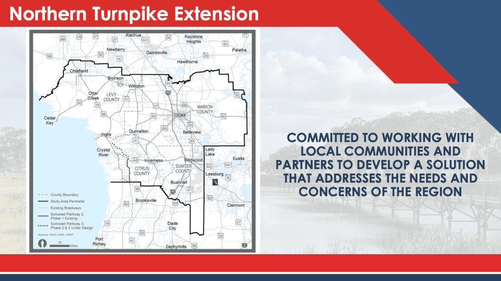
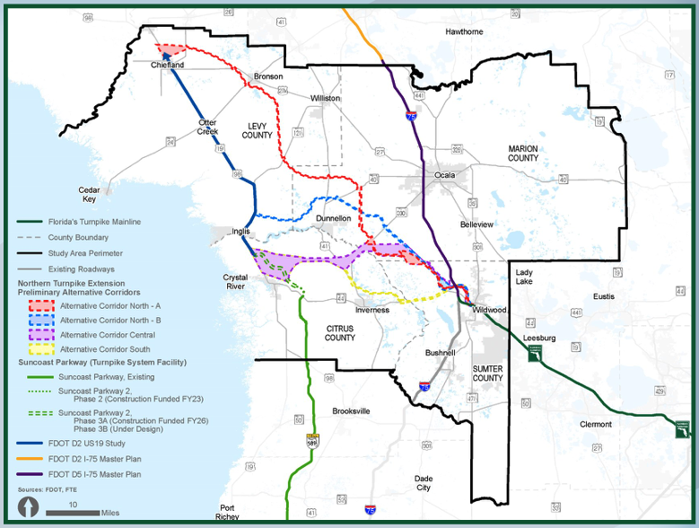
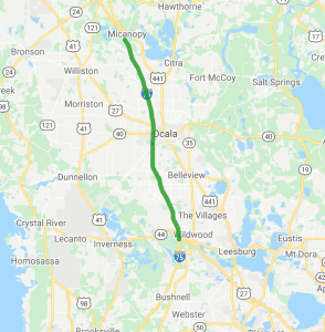
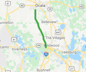
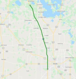
In October 2021, Florida’s Turnpike Enterprise (FTE), part of the Florida Department of Transportation (FDOT), began an Alternative Corridor Evaluation (ACE) study to evaluate the extension of Florida’s Turnpike from its northerly terminus in Wildwood to a logical and appropriate terminus as determined by FDOT.  The Northern Turnpike Extension (NTE) study area includes Citrus, Levy, Marion, and Sumter counties.

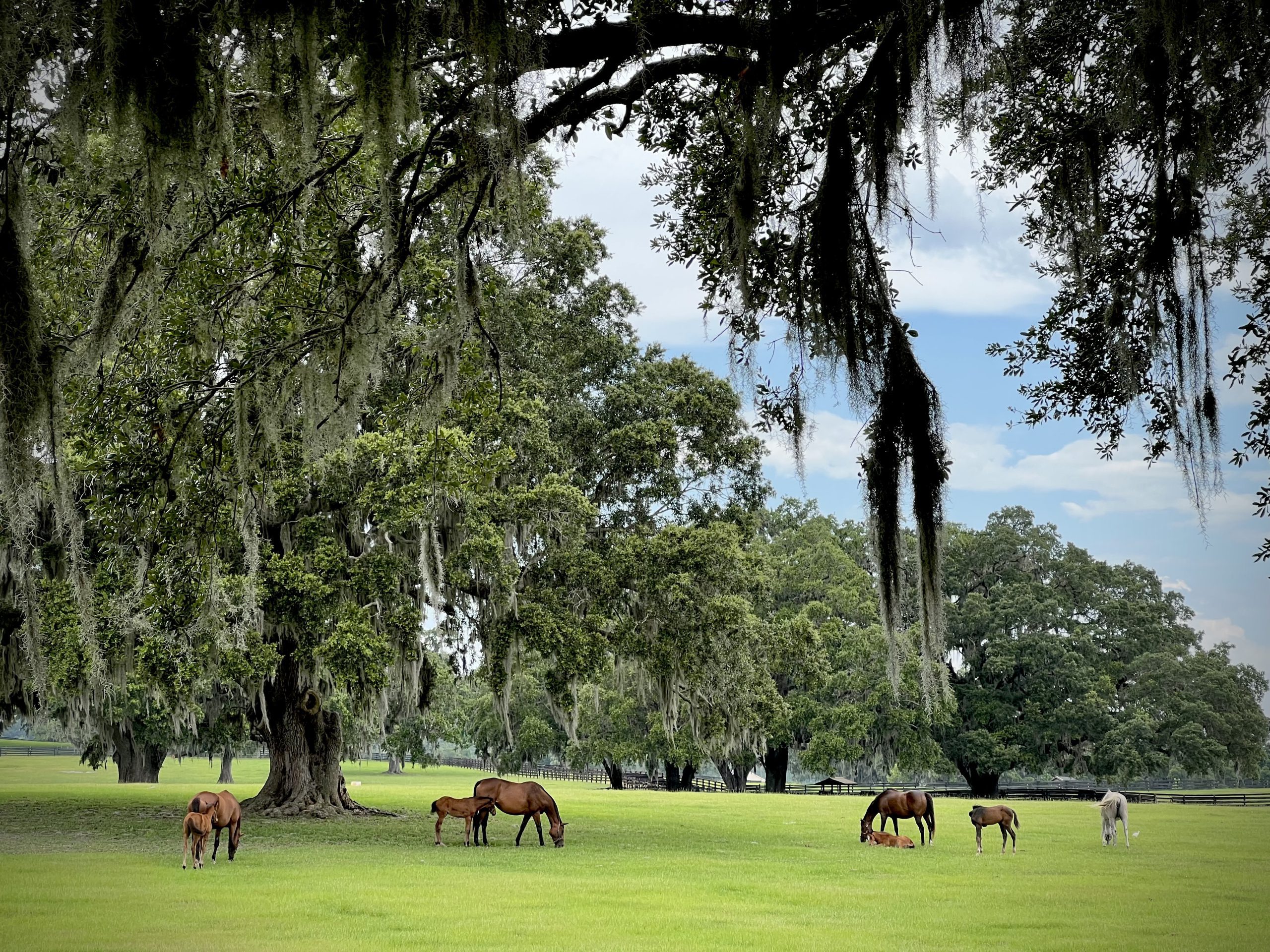
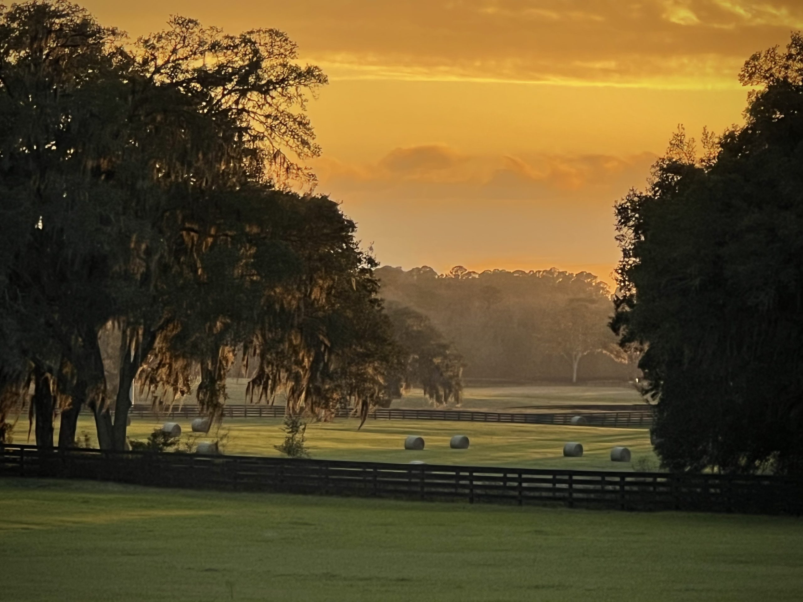
Horse Farms Forever® has taken a neutral position on the ACE Study because the four proposed corridors were not located inside the Farmland Preservation Area.

HFF’s policy statement on transportation reads: Any new road projects within the Farmland Preservation Area should use existing rights-of-way. This position aligns with Marion County’s Comprehensive Plan Policy 3.3.1 Elements of Rural Character which states: “Transportation: New transportation corridors intended to be used specifically for the construction of expressways or limited access roadways shall avoid the Farmland Preservation Area.”

In our role as a watchdog of government actions, Horse Farms Forever® staff recently met with members of the NTE project team from FTE to learn more about the process of developing corridors and the parameters used to evaluate corridor alternatives, and ultimately select a route for the proposed NTE.

Phase 1 Is All About Choosing A Corridor

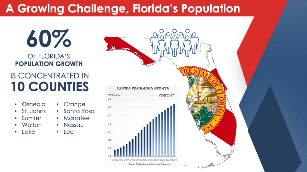
In the next 20 years, Florida’s population is projected to increase by five million people to 26 million residents.(1) With this expected population growth, the transportation systems must also grow to provide a safe and reliable transportation network. To accommodate this growth, FTE is conducting a study to evaluate an extension of Florida’s Turnpike. The ACE process is used to identify, evaluate, and eliminate alternative corridors on qualifying projects. The main goal of the ACE study is to narrow the potential four corridor alternatives down to one corridor.

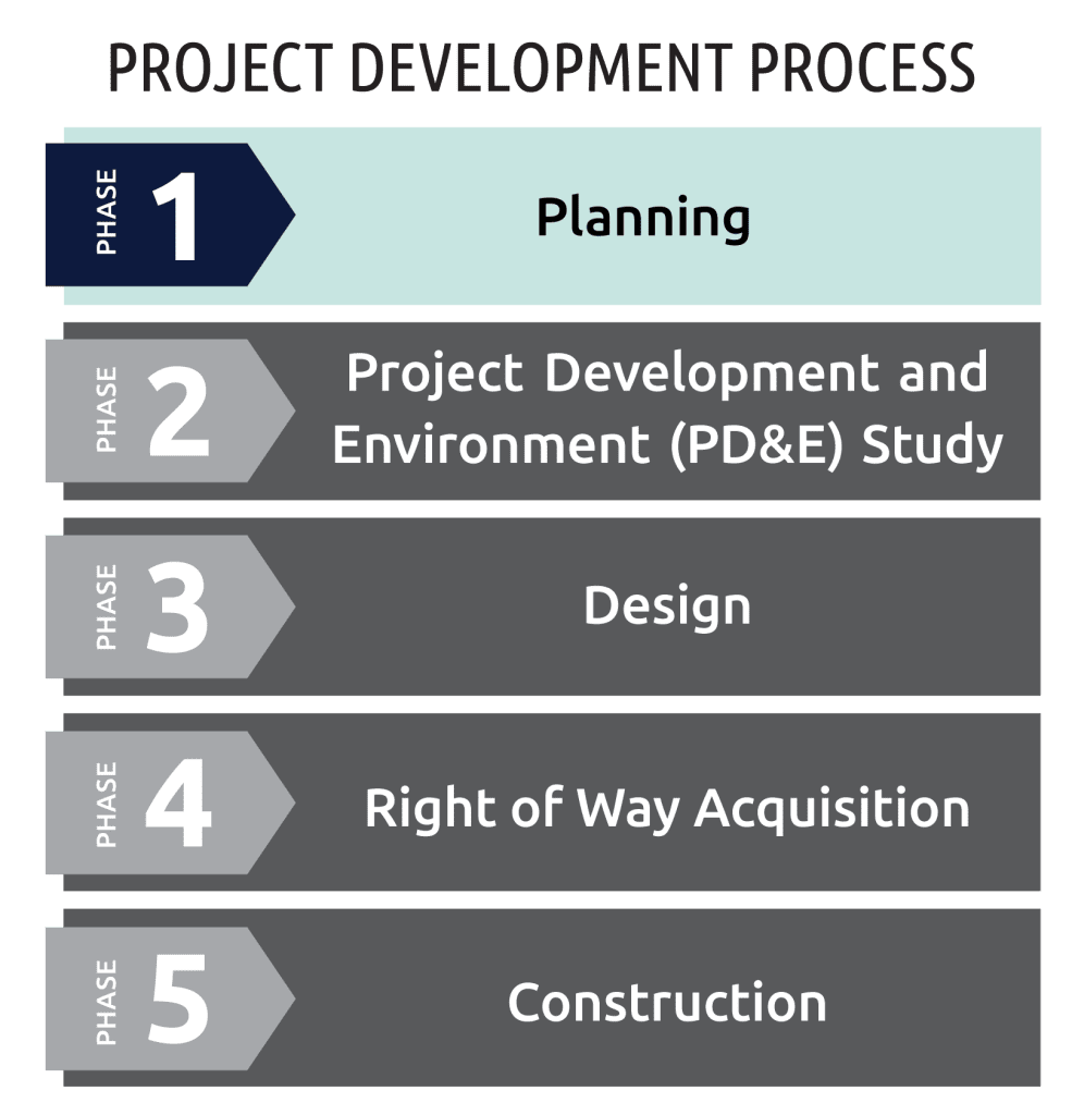
Phase 2 Will Look At Several Alignments – And Also No Build

The recommended corridor from the ACE study is the basis for Phase 2 of the project, the Project Development and Environment (PD&E) study phase. In this phase, the recommended alternative corridor goes through further detailed evaluation to refine a range of alternatives within the selected corridor. The PD&E study will also evaluate a No-Build option as well as potential Transportation Systems Management and Operations (TSM&O) improvements such as ramp signals or work zone traffic management.

“It’s a long process and we are very early in the planning phase. There are five steps from planning to construction and finally operation,” said William Burke, FTE Project Manager (HDR). “We are evaluating all of the corridors against the goals of the project, but also how they impact the environment, traffic, and cost.”

Jennifer Stults, FDOT Planning and Environmental Management Administrator, emphasized that this phase is focused on mapping by using Geographic Information Systems (GIS) data and characterized it as an exercise in avoidance to help protect environmentally sensitive areas, natural resources and residential areas.

“At this phase, the corridors are broad to allow us to evaluate the area, but we will narrow the focus and refine the corridors based on information that is processed. This will allow us to accommodate those areas that we want to avoid,” said Stults. She also emphasized that the project team is sensitive to local land use decisions and conservation areas. “We want to be a good partner,” said Stults. “We work closely with our local partners to identify some of the things in process that we would not be aware of yet. This is why our ongoing robust community engagement work is so important. We absolutely want to hear from our stakeholders.”

For example, not only are existing conservation areas avoided, but also the areas that have been identified for conservation as part of a local or state program, or those areas that are part of the optimum boundary of the conservation area. In addition to public conservation lands such as state parks, the team is also mindful of privately-owned land with a conservation easement that has been delineated in the GIS mapping data.

 “There are a lot of different types of conservation land with different types of habitat, and if there is land with a conservation easement here and one without a conservation there, we are going to route around the land with the easement whenever possible,” said Burke. “There could be some exceptions, but generally speaking we would avoid those areas as much as possible.”

Conservation Is Written Into The Statute

The ACE study will identify preliminary environmental impacts and any potential impacts to existing conservation lands will be further evaluated and mitigated in the PD&E study to the greatest extent possible. 

There are two important sections in the enabling Statute to mitigate environmental impacts:

(7) The department shall consider innovative concepts to combine right-of-way acquisition with the acquisition of lands or easements to facilitate environmental mitigation or ecosystem, wildlife habitat, or water quality protection or restoration.

(8)(b) To the greatest extent practicable, roadway alignments, project alignment, and interchange locations shall be designed so that project rights-of-way are not located within conservation lands acquired under the Florida Preservation 2000 Act established in s. 259.101 and the Florida Forever Act established in s. 259.105.

NTE Scope Is Narrower than M-CORES

The NTE and Multi-use Corridors of Regional Economic Significance (M-CORES) program are different projects. The goals of the NTE are to enhance regional connectivity, accommodate increased travel demand, address regional congestion and safety, and improve emergency response. The M-CORES program conversely had a broader statewide goal of implementing regional corridors that were intended to accommodate multiple modes of transportation and multiple types of infrastructure. The M-CORES program was planned to address various issues beyond those typically accommodated in FDOT projects such as broadband, water, and sewer connectivity; energy distribution; trade and logistics; mobility as a service; and availability of a trained workforce skilled in traditional and emerging technologies, among others.

During the 2021 legislative session, Florida Statute 338.2278, repealed M-CORES.  The same legislation authorized study of the NTE. 

Interchange Features Can Be Controlled By Local Governments

The project team will work with local governments to determine the location of proposed interchanges and to determine the features of the interchange, such as a gateway feature or region-specific landscape features. Local governments can also include restrictions in the comprehensive plan to determine development around the interchange. This is one way to reduce urban sprawl.

“In Citrus County, there is an interchange management plan,” said Stults. “Also, along the Turnpike, with limited access, there are areas where minimum development has occurred for decades. That is where the local planning agencies are able to choose what they would like to see happen in their community.”

Project Schedule Is Driven By Public Interest

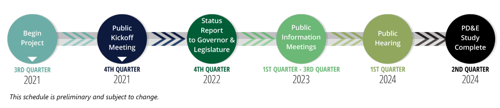
FTE initiated the planning phase of the Northern Turnpike Extension project in October 2021. The project is currently in early stages of development with the Efficient Transportation Decision Making screening and the ACE underway. Based on the high level of engagement and interest, FDOT is increasing opportunities to engage with local governments, stakeholders, and residents within the study area. The additional engagement efforts and increased public interest are underway and will continue to influence the project schedule. The project website remains an up-to-date and dependable resource for information and opportunities to provide feedback. Public engagement will continue to shape how the Northern Turnpike Extension supports regional and statewide needs as it moves through all phases of the project development process.


Source: Northern Turnpike Extension – Florida’s Turnpike (floridasturnpike.com)

NTE End Point Will Be Decided

 One of the main goals of the ACE study is to determine the project limits. Stults also emphasized that public participation is important and will help influence the route of the corridor.

 “The Northern Turnpike Extension will end at a point that is to be determined only after further study is completed and feedback from stakeholders is reviewed. We are still in that gathering process,” said Stults.

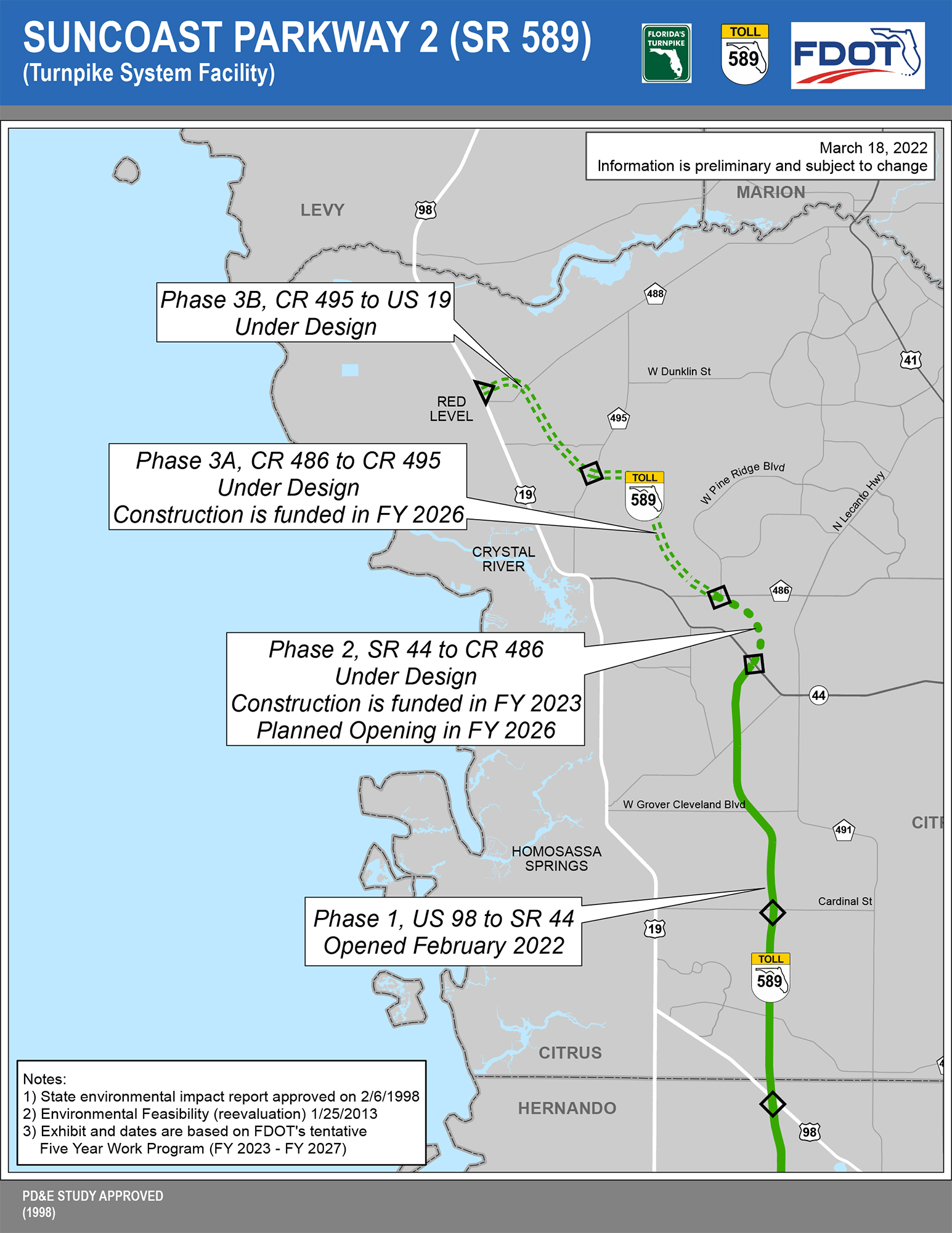
Because SB 100 (2021) gave the FDOT the authority to determine the end point for the NTE, it does not have to connect with the Suncoast Parkway. This gave the project team more flexibility when developing the four corridor alternatives.

The two northern corridor alternatives end at different locations along US 19 (98), while the central and the southern corridors end at US 19 (98) or the future location of the Suncoast Parkway. The longest corridor (Alternative Corridor North A) stretches nearly 75 miles across three counties to end at Chiefland. The three other corridors take a more westerly direction and are much shorter.

The legislation requires the FDOT to take into consideration the previous task force reports. These reports may help determine the route.

 (6) Any existing applicable requirements relating to turnpike projects apply to projects undertaken by the Turnpike Enterprise pursuant to this section. The Turnpike Enterprise shall take into consideration the guidance and recommendations of any previous studies or reports relevant to the projects authorized by this section and ss. 339.67 and 339.68, including, but not limited to, the task force reports prepared pursuant to chapter 2019-43, Laws of Florida, and with respect to any extension of the Florida Turnpike from its northerly terminus in Wildwood.

***

Horse Farms Forever® thanks the Florida’s Turnpike Enterprise team for taking the time to discuss the process of selecting corridors and the parameters used to select a route for the proposed Northern Turnpike Extension project. 


Public Input Requested

In addition to holding public meetings, the Department engages the public on all its projects and welcomes your feedback.

The project team also strongly encourages residents to submit comments using the online comment form.

 “Just keep an open mind and give us as many detailed comments as you want to submit,” said Stults. “Folks are entitled to their opinion, but the more specific the suggestions are, the more it helps the team fine-tune the route.”

For other project information, please contact:

William Burke, PLA

Project Manager
Florida’s Turnpike Enterprise (HDR)

407-264-3142 | william.burke@dot.state.fl.us

Northern Turnpike Extension Webpage: www.floridasturnpike.com/NTE


Suncoast Parkway 2 Under Construction

The Suncoast Parkway 2, or the Suncoast extension, is shown on the study area map for the Northern Turnpike Extension project, but it is a separate road improvement project that is located entirely in Citrus County. Phase 1 of the Suncoast Parkway extension was recently opened to traffic and ends at SR 44. Phases 2 and 3 are in the Design Phase and sections of the road are funded for construction. These sections combine for 13 miles, starting at SR 44 and connecting to US 19.

Here’s a link to a detailed map, information, and schedule. 

It is the vision and mission of Horse Farms Forever to inspire conservation of horse farms through education, awareness and idea exchange so as to preserve natural pasture land focusing on horses and their habitats, to protect soil and water on which they depend, and minimize land use conflicts
in Marion County, Florida.

We are watchful of government and others to preserve and protect horse farms and farmland for future generations - especially in the Farmland Preservation Area. We are neither anti-growth nor anti-development; we encourage urban growth to remain inside the Urban Growth Boundary.

Horse Farms Forever® is a Florida not-for-profit corporation registered with the Florida Department of Agriculture and Consumer Services as a charitable organization and approved as a tax-exempt 501(c)(3) corporation by the Internal Revenue Service. Horse Farms Forever® does not have a political mission. Our status as a 501(c)(3) charitable organization does not allow us to participate or intervene in political activities. The organization will neither advocate on behalf of political candidates nor advocate for the passage of legislation.


The Master Plan For I-75

The Master Plan For I-75

From The Turnpike to CR 234 – The Latest on Fifty Miles of Improvements

There is no doubt that I-75 is near capacity. To accommodate the projected population growth and increased truck traffic, the road’s capacity will have to be expanded.

Over the next 20 years, Marion County’s population will grow by about 150,000 new residents to reach nearly half a million people. In addition, the industrial warehouse space will increase to a total of 17M square feet. About half of the existing 11M square feet of industrial warehouse space is used by five distribution centers and an additional six million square feet of industrial warehouse space will be completed over the next 12 to 18 months.

This exponential growth will stretch the capacity of I-75 to its limits.

I-75’s capacity issues have been on the Florida Department of Transportation’s (FDOT) radar since 2016, with the formation of the I-75 Relief Task Force. The top recommendation from the Task Force was to improve the capacity of I-75. The second recommendation was to improve existing roads such as 41, 441 and 301.

In 2018, the Coastal Connector was proposed by FDOT, but since that was rejected, I-75 became the focus again in 2019. (The Northern Turnpike Extension was proposed by the Florida Turnpike Enterprise (FTE), which is part of FDOT in 2021).

Scope Of The Project

In 2021, FDOT decided to take a step back and refresh the Master Plan for I-75. The project starts in Sumter County at the northern terminus of Florida’s Turnpike in Wildwood and goes north for 47.8 miles to County Road (CR) 234 just north of Marion County. 


The Master Plan will only evaluate upgrading I-75 within the existing corridor. The project is divided into two sections for the purposes of the study.

Section 1 starts at the Florida Turnpike to 22.5 miles north to State Road (SR) 200.

Section 2 starts at SR 200 in Marion County to 25.3 miles north to County Road (CR) 234 in Alachua County.

Timeline

The work on the I-75 Master Plan began in June, 2021. The draft  Master Plan report will be available sometime in June, 2022. A public meeting will be held in summer, 2022 for public comment and the final Master Plan report is due in November, 2022. The next phase is PD&E followed by Design and Construction. The FDOT Project Manager for the I-75 Master Plan is Mary McGehee. FDOT is also working with two consulting engineering firms, Volkert and HDR, Inc. to conduct the I-75 Master Plan study.

“The Master Plan will look at the short-term and the long-term solutions,” said Steven Schnell, an engineer with HDR, Inc. “The long-term solution looks out to 2050 and what needs to be done. This is such a long corridor and it will be implemented in phases to determine what is the best strategy and plan going forward.”

Some of the short-term solutions include enhanced ramps and better signals at some of the interchanges. The intersections at CR 236, SR 40 and SR 200 will also be improved.

“The biggest issues are at CR 326,” said McGehee. “That’s where the trucks are getting on and off of I-75. The two truck service centers at this intersection also adds to the congestion as the trucks intermingle with the cars.”

The long-term improvements will be included in the Master Plan study and potentially include adding two additional lanes and new interchanges. The goal is to improve the traffic flow and safety, and to further reduce the amount of time to clear traffic incidents. The variation in the traffic due to the holidays, weekends, inclement weather, incidents and the truck traffic will also be addressed in the report.

Ocala’s Strategic Location

FDOT has the Herculean task of planning for the future transportation needs for Marion County. The good news is that the majority of the road improvements are made within existing corridors.

Marion County is growing quickly and the roads must also grow. Ocala’s strategic location between several major cities and readily available land along I-75 is one of the reasons several large distribution centers have chosen Ocala for their relocation or expansion needs. For tourists and commuters, I-75 is also the most direct route to the Turnpike and to south Florida’s popular west coast.

42 Projects

There are currently 42 FDOT projects in Marion County that are at various stages. You can submit comments or ask a question about each project on the FDOT District Five website.

We’ll Be Watching

The improvement of I-75 is one of the most significant transportation issues facing the county. I-75 also runs through the Farmland Preservation Area, so we will be monitoring the I-75 Master Plan and attending the public meeting this summer. We thank the FDOT team for updating us about the road improvement project because it will have a tremendous impact on the quality of life in Marion County. FDOT has decades of institutional experience and their goal is to make I-75 better and safer for all travelers.


Already In The Design Phase

New I-75 Interchange at NW 49th Street/NW 35th Street

The Florida Department of Transportation (FDOT) is building the new interchange at NW 49th Street/NW 35th Street. According to the FDOT website, the Project Development and Environment (PD&E) Study was completed in March 2021 and the project is currently in the design phase. The FDOT Design Project Manager is Megan Owens and the Design Firm is Metric Engineering.

Construction is anticipated to begin in August of 2024. The cost of the project is approximately $41 million for construction. The estimated time frame for completion is 1 to 3 years.

Read our blog on this project

Link to the PD&E study and a comment form to send comments to FDOT.

Busy Shires

What About Zoning?

The Zoning regulations are found in the Land Development Code, which is a separate document with specific guidelines to implement the Goals, Objectives, and Policies of the Comprehensive Plan.

Zoning regulates development through land use classifications and specifies the areas in which residential, industrial, recreational or commercial activities may take place. The Land Development Code was adopted through a series of ordinances by the County Commission, which means that the regulations cannot be changed or waived, except by a further vote of the County Commission.

Always Watching

We work hard to keep you informed, and to represent our members' interests in preserving our horse farms, farmland and the unique character and culture of Marion County's 193,000 acre Farmland Preservation Area.

Join the herd. Every voice matters.

UPDATE: SW/NW 80th/70th Avenue Road-Widening

UPDATE: SW/NW 80th/70th Avenue Road-Widening

Four-Lane Widening of SW/NW 80th/70th Avenue Approved

At the Marion County Commission meeting on Tuesday, December 7th, the Preliminary Engineering Report (PER) was approved for the 10.5-mile segment of SW/NW 80th/70th Avenue. This road will be widened to four lanes, starting at SW 90th Avenue to 0.5 miles north of US Hwy 27. Funding for design of phased portions of the corridor is available in the current budget. The road project is divided into three sections for construction, but only two of the three sections are funded.

Paul Wildman, P.E., from Guerra Development Group presented the PER, a 900-page document with detailed maps and conceptual designs of the proposed road. The PER report is the first phase. The next three phases are: design, right of way acquisition, and construction.

Alignments

Two different roadway alignments, A and B, were presented for approval. The County Commission voted to approve Alignment A.

Alignment A consists of reducing the amount of impacts and meanders through the corridor,” said Wildman. “The other option is Alternate B, which takes a centerline approach and the need for right of way and improvements is along both sides of the corridor,” he said.

Expand Photo

Alignment A also received more support from the public meeting comments. It avoids impacts to the cemetery and costs less to construct.


Designs

The County Commission also selected Major Typical Section 2 as the preferred design of the road. This design is 120 feet wide and includes a bike lane adjacent to the travel way, a sidewalk on the east side, and a multi-use path on the west side of the road.

Expand Photo


Special Case Scenarios

In addition to the Major Typical Sections, there were several “special case scenarios” identified in the report as Minor Typical Sections. The section of the road near On Top of the World (OTOW) is one example because a multiuse path already exits. An agreement will be negotiated with OTOW to utilize this existing path instead of building a new path.

County Commissioner Stone also requested berms be built to address the traffic noise and to help block the view of the traffic. This will also be considered during the design phase of the road.

The improvements of the intersection at NW 41st Place Road are also in the concept design phase. One option is to include an extra long turn lane and improve the intersection to allow for U-Turns. Other design concepts include a frontage road, or to connect NW 41st Place Road to SW 52nd Street. The intersection improvements will allow horse trailers and large recreational vehicles to safely change direction on the road. The final design will be brought back to the County Commission for approval.

Intersection Improvements

The traffic report shows the need to improve seven major intersections for safety. The following intersections are recommended to be improved through the 2045 design year:

  • SW 80th Avenue at SW 90th Street- Additional turn lanes and signal updates.
  • SW 80th Avenue at SW 80th Street- Additional turn lanes and signal updates.
  • SW 80th Avenue at SW 63rd Street Road- New Signal and additional turn Lanes.
  • SW 80th Avenue at SW 38th Street- Additional turn lanes and signal updates.
  • SR 40 at NW/SW 80th Avenue- Additional turn lanes and signal updates.
  • NW 80th Avenue at NW 21st Street – New Signal and additional turn Lanes.
  • US 27 at CR 225A- Additional turn lanes and signal updates.

Other Issues

The report also addressed several issues such as number of residences affected, feasibility of design/permitting, costs, environmental impacts such as wetlands and protected species, cultural/archaeological factors including a local cemetery, and infrastructure flexibility to meet future needs.

The report includes feedback from major stakeholders, government agencies, the County Commission, the County Engineer, and the public. Two meetings were held at Westport High School to take public comment on the road in July 2021. Guerra provided responses to all of the public comments submitted.

Three Sections

  • Segment 1: From SW 90th to just north of Westport High School is funded and construction is expected to start within the next three years.
  • Segment 2: Just north of Westport High School to south of SR 40, but this section is not funded and funding is not anticipated for at least 5 years.
  • Segment 3: Just north of SR 40 to US 27 is funded and construction will start within the next three to five years.

In addition, two new intersection improvements at SR 40 and US Hwy 27 are funded. The intersection at SR 40 will likely to go to construction next year. The intersection at US Hwy 27 is under construction now. (See update below about the US Hwy 27 intersection).

The full PER can be viewed at the following link: https://bcc.marioncountyfl.org/Full_Preliminary%20Engineering%20Report_SW%20NW%2080th%2070th%20Ave_Nov%202021.pdf

The SW/NW 80th/70th Avenue road-widening project was approved in 2018 as part of the Transportation Improvement Program (TIP). The TIP is a five-year schedule of transportation projects proposed by government agencies and other stakeholders in Marion County. https://ocalamariontpo.org/plans-and-programs/transportation-improvement-program-tip/

Updates on US Hwy 27 And The New Road/Interchange at NW 49th Street

Aerial view of the parcel# 13561-004-00. This is where the four-laning will end and the new road at NW 49th Street will meet 225A. Expand Photo

1. When will the extension North of US Hwy 27 be completed?

NW 70th Ave/CR 225A and US Hwy 27: The improvements to the intersection at NW 70th Ave/CR 225A and US Hwy 27 is the first road improvement project for SW/NW 80th/70th Avenue and it is currently under construction by Marion County. The estimated horizon for completion is mid March 2022. However, the completion date may extend to April 2022.

The road will be converted to a four-lane divided roadway that extends approximately 600 feet on both sides of US 27. The road improvements include turn-lanes, bike lanes, curb and gutter, concrete sidewalks, shared use path, medians, storm drainage, drainage retention areas, traffic markings and signals, ditches, berms, driveways, water mains, and sanitary sewer mains.

As part of Section 3 in the Preliminary Engineering Report (PER) for the SW/NW 80th/70th Avenue Road Widening project, CR 225A will be four-laned from the US Hwy 27 intersection improvements to the new road, NW 49th Street, that will connect CR 225A to the new I-75 Intersection. Section 3 is currently under design. This Section is funded and construction will start within the next three to five years.

The four-laning of CR 225A will end at about NW 44th Lane. The parcel number where the four-laning will end is 13561-004-00.

2. When will the new interchange at I-75 will be built?

New I-75 Interchange at NW 49th Street/NW 35th Street: The Florida Department of Transportation (FDOT) is building the new interchange at NW 49th Street/NW 35th Street. According to the FDOT website, the Project Development and Environment (PD&E) Study was completed in March 2021 and the project is currently in the design phase. The FDOT Design Project Manager is Megan Owens and the Design Firm is Metric Engineering.

Construction is anticipated to begin in December of 2024. The cost of the project is approximately $41 million for construction. The estimated time frame for completion is 1 to 3 years. Link to the PD&E study and a comment form to send comments to FDOT: https://www.cflroads.com/project/435209-1

This interchange will extend from the NW 35th Street extension, which Marion County is constructing, to the Amazon warehouse. The new street will go through the mining operation. The interchange will go over I-75, via a bridge, from NW 35th Street on the east side and it will tie into the existing NW 49th Street on the west side of I-75. This is a Diverging Diamond Interchange configuration. There will be a brand new intersection built at NW 49th Street and NW 44th Ave. Traffic will have access to NW 44th Ave, which runs parallel to I-75 and connects to US Hwy 27 and Hwy 326

3. When will the road that connects CR 225A to I-75 be built?

NW 49th Street: Connects CR 225A to new I-75 Interchange at NW 49th Street: The connection of CR 225A to the interchange at NW 49th Street will be built in two sections: 3A and 3B. Both sections are funded for design. Section 3A is funded for construction in fiscal year 2020/2021. Section 3B is funded for construction in 2022/2023.

The general rule of thumb for road construction projects is that the design phase is one year. The next phase is to acquire the right of way, which takes up to one year or more and the final phase is construction, which is one year or less. Sometimes the right of way acquisition and construction overlap.

Section 3A: The design for Section 3A has been started and the construction is funded for fiscal year 2020/2021, which began on October 1, 2021. The cost for the 1.1-mile section of the two-lane road is $2,000,000.

3A runs from a location point which is located 1.1 miles west of NW 44th Avenue to NW 44th Avenue. Deputy County Engineer Don Atwell is the Project Manager for Section 3A. See item number C5 on the 2020/2021 – 2024/2025 Marion County Transportation Improvement Program
https://www.marionfl.org/home/showpublisheddocument/20890/637245315041870000

Section 3B: The design for Section 3B has not been started. The right of way acquisition is funded for fiscal year 2021/2022 at a cost of $780,000 and construction is funded for fiscal year 2022/2023 at a cost of $4,450,000.

3B starts at CR 225A and ends at the beginning of Section 3A at the location point 1.1 miles west of NW 44th Avenue. See item number C10 on the 2021/2022 – 2025/2026 Marion County Transportation Improvement Program. https://www.marionfl.org/home/showpublisheddocument/22134/637605811040870000

Always Watching

We work hard to keep you informed, and to represent our members' interests in preserving our horse farms, farmland and the unique character and culture of Marion County's 193,000 acre Farmland Preservation Area.

Join the herd. Every voice matters.