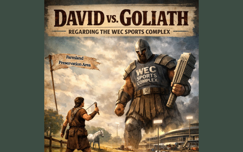
David vs. Goliath Regarding the WEC Sports Complex
 (3)")

Over a week ago, the Marion County Commission voted 5-0 to approve Golden Ocala Equestrian Land’s applications to allow for the sports and entertainment complex – a massive project spanning 251 acres, even larger than Disney’s Wide World of Sports.
From the announcement of the project last year, Horse Farms Forever has stood in what feels like a classic David versus Goliath battle—our small but mighty nonprofit facing an intense commercial development of overwhelming scale and influence.
The Role of the Comprehensive Plan
But like David, we were not without our stone. That “stone” is the County’s own Comprehensive Plan. As County Attorney Guy Minter has stated many times, the Comprehensive Plan is “Marion County’s constitution” that guides growth and development.
The Golden Ocala applications included hundreds of pages of complex information regarding the land use amendments, zoning changes, and the development agreement. That’s why our team of professionals includes a top-tier land use attorney and an AICP-certified planner. We work hard to provide fact-based information to ensure the accuracy and credibility of our position statements.
For example, G. Matthew Brockway, recognized by his peers as a Best Lawyer in Florida for Litigation – Land Use and Zoning, provided competent and substantial evidence at the July 21, 2025 transmittal hearing. Matt also provided a letter to the County Commission concluding that these applications are inconsistent with the County’s Comprehensive Plan.
Why This Matters Moving Forward
And in this context, the David versus Goliath analogy remains fitting— while the outcome was not what we had hoped, we held Golden Ocala accountable, and we will continue our battle to protect Marion County’s title as the Horse Capital of the World®.
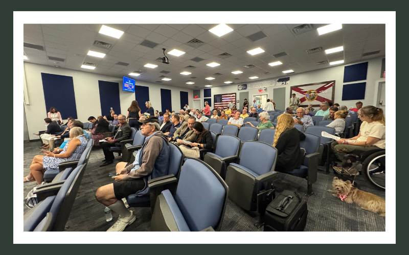
Horse Farms Forever is the only organization that shows up at every meeting with a team of respected professionals. Our strength comes from the broad-level support from our members and horse farm owners. Your support makes a difference.
Horse Farms Forever Statement
When Golden Ocala Equestrian Land asked the county to move the boundary of the Farmland Preservation Area, they promised to build the World Equestrian Center. Golden Ocala kept that promise and what they have built is spectacular. It shows a passion for equestrian activities, and has changed Ocala forever. We applaud their efforts and thank them for being founding members of Horse Farms Forever.
However, the WEC Sports Complex has nothing to do with horses. Instead, it puts an intense commercial activity on property reserved for low density residential equestrian estates meant to act as a transition to the Farmland Preservation Area. Its approval corrupts the integrity of our comprehensive plan and land development code.
Please Join Us
Now more than ever, we need your help.
Your donation directly supports Horse Farms Forever’s ability to retain the high level of professional expertise required to defend the Farmland Preservation Area and to continue fighting for responsible growth in Marion County.
This is not the time to step back. It is the time to stand together.
If you believe in protecting the integrity of the Comprehensive Plan, preserving the character of our horse country, and defending the future of Marion County as the Horse Capital of the World®, please make your donation today.
Every gift matters. Every voice matters. Every act of support strengthens this fight.
")
")
")
 (3)")


")

")


 (1200 x 200 px) (6)")

")

 (26)")
")